About Machu Picchu
Machu Picchu is the Lost City of the Incas, a cloud-shrouded citadel perched on a narrow ridge in the Andes that was hidden from the world for centuries. Built without the wheel or iron tools, its stone walls are fitted together so perfectly that not even a knife blade can fit between them. It is a place of profound mystery—was it a royal estate, a religious site, or a fortress? The silence of the stones keeps its secrets.
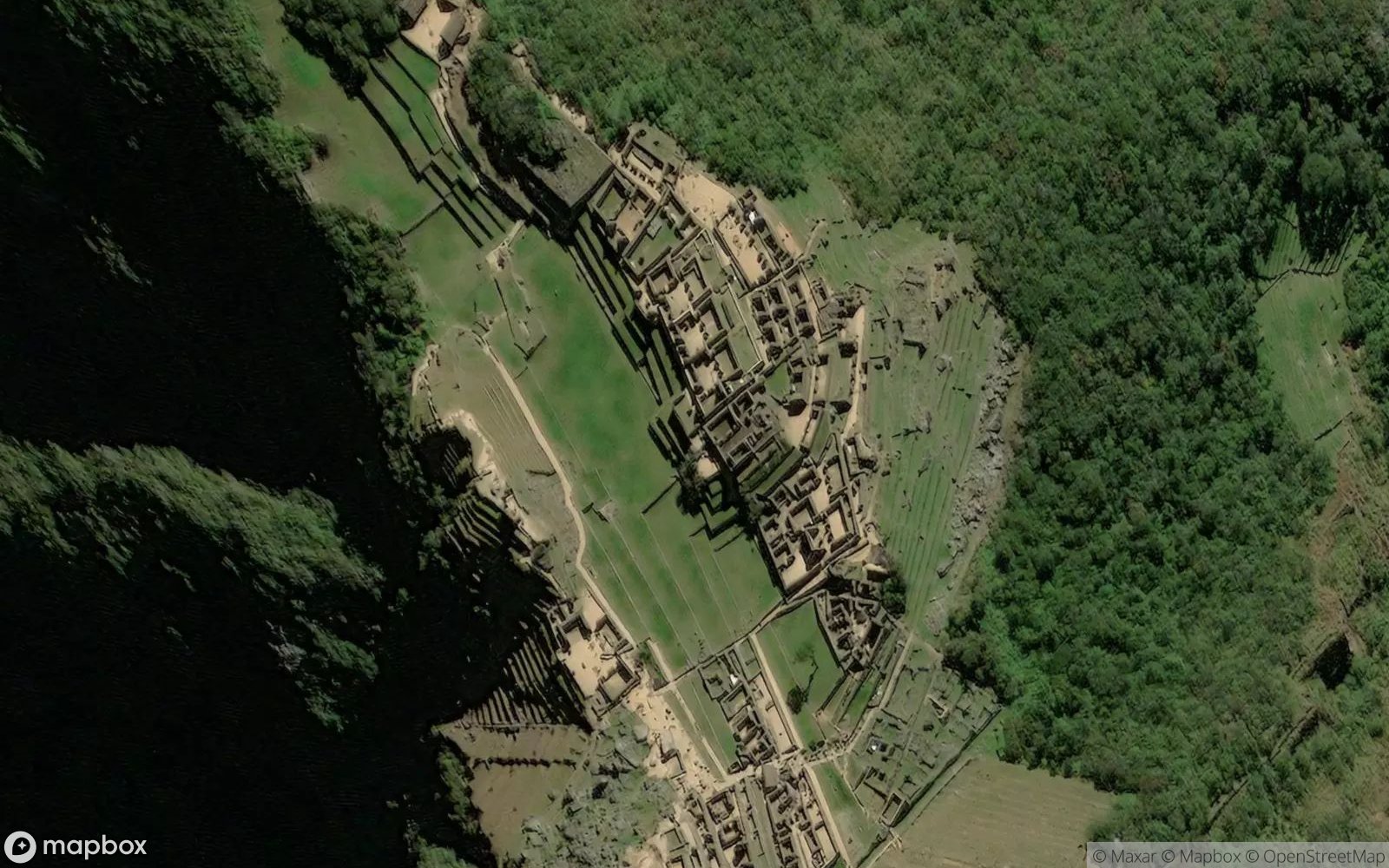
Satellite views show its impossible location: a saddle between the peaks of Machu Picchu and Huayna Picchu, surrounded on three sides by the deep gorge of the Urubamba River far below. It looks like a secret island in the sky, protected by vertical cliffs and jungle. The agricultural terraces step down the mountainside like a green staircase, stabilizing the slopes and feeding the inhabitants.
The morning mist clearing to reveal the ruins is a spiritual experience. The Intihuatana stone, the "hitching post of the sun," speaks to the Incas' advanced understanding of astronomy. It is a place where the earth and sky meet, a harmony of landscape and architecture that feels organic. Machu Picchu is not just a ruin; it is a poem written in stone against the backdrop of eternity.