About Stonehenge
Stonehenge is a prehistoric riddle on the Salisbury Plain, a ring of massive sarsen stones that has stood for 5,000 years. Who built it? Druids? Romans? Bronze Age farmers? And why—temple, calendar, or healing center? It stands solitary and windswept, a masterpiece of engineering from a time before the wheel. The lintels balanced atop the standing stones are a feat of physics that still puzzles experts.
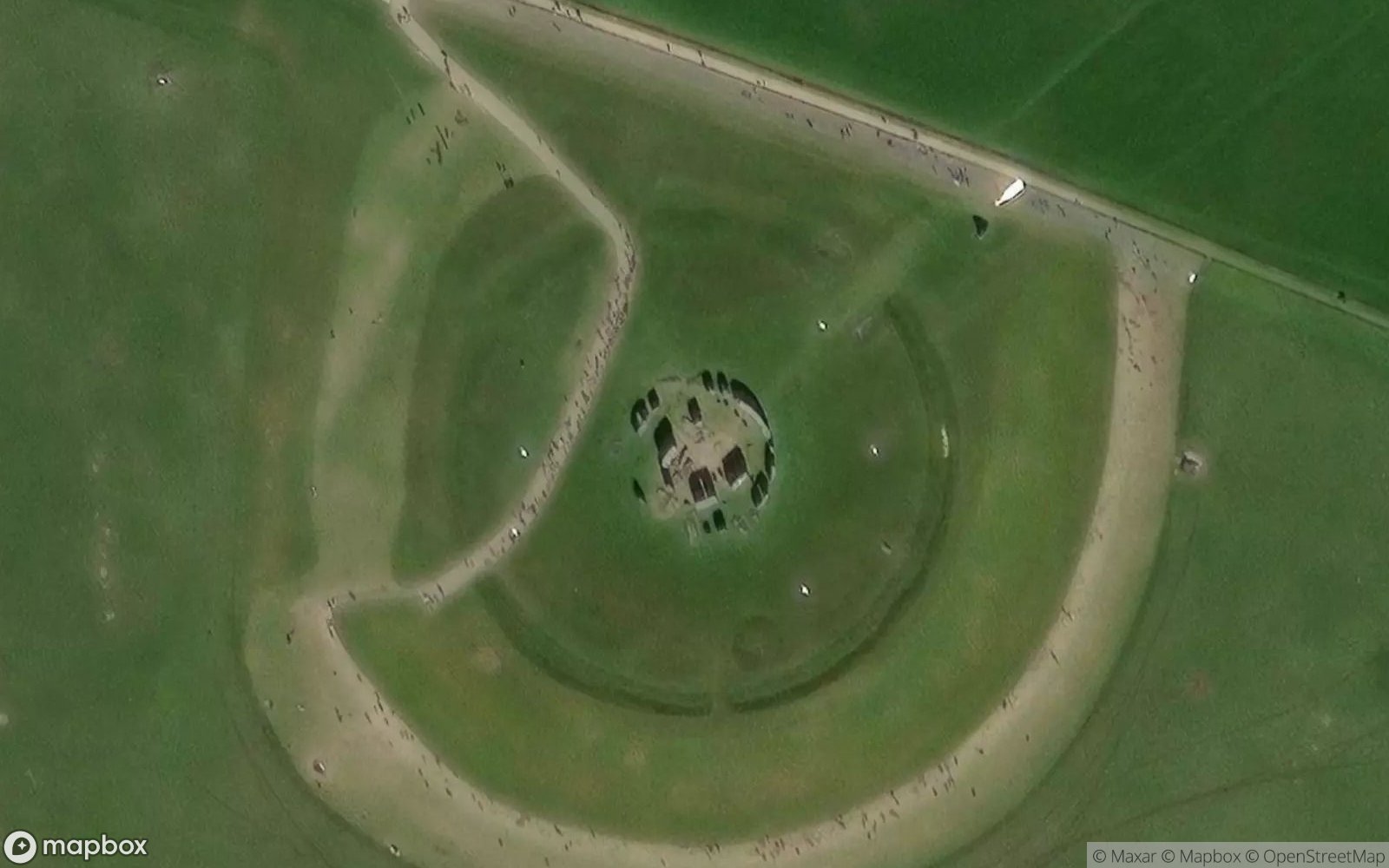
From above, the circular layout is unmistakable. The outer circle, the inner horseshoe of trilithons, and the surrounding ditch and bank (the "henge") form a sacred geometry in the green fields. The "Avenue," an ancient processional pathway, can be seen leading to the river. It sits at the center of a landscape dense with burial mounds and other ancient earthworks, a vast sacred necropolis.
The best time to see Stonehenge is at sunrise or sunset, when the stones cast long shadows and align with the sun. Despite the nearby highway, there is a primal power here. It connects us to our ancestors' obsession with the fierce passage of time and the seasons. It is silent, heavy, and undeniably sacred, a cathedral of the open sky.