About Acropolis
The Acropolis of Athens is the quintessential symbol of Western civilization, a rocky outcrop that has watched over the city for millennia. Crowned by the Parthenon, it stands as a testament to the Golden Age of Pericles, to democracy, and to the pursuit of perfection. The marble columns, honey-colored in the afternoon sun, rise from the bedrock in perfect harmony, visible from almost every corner of the sprawling modern city below.
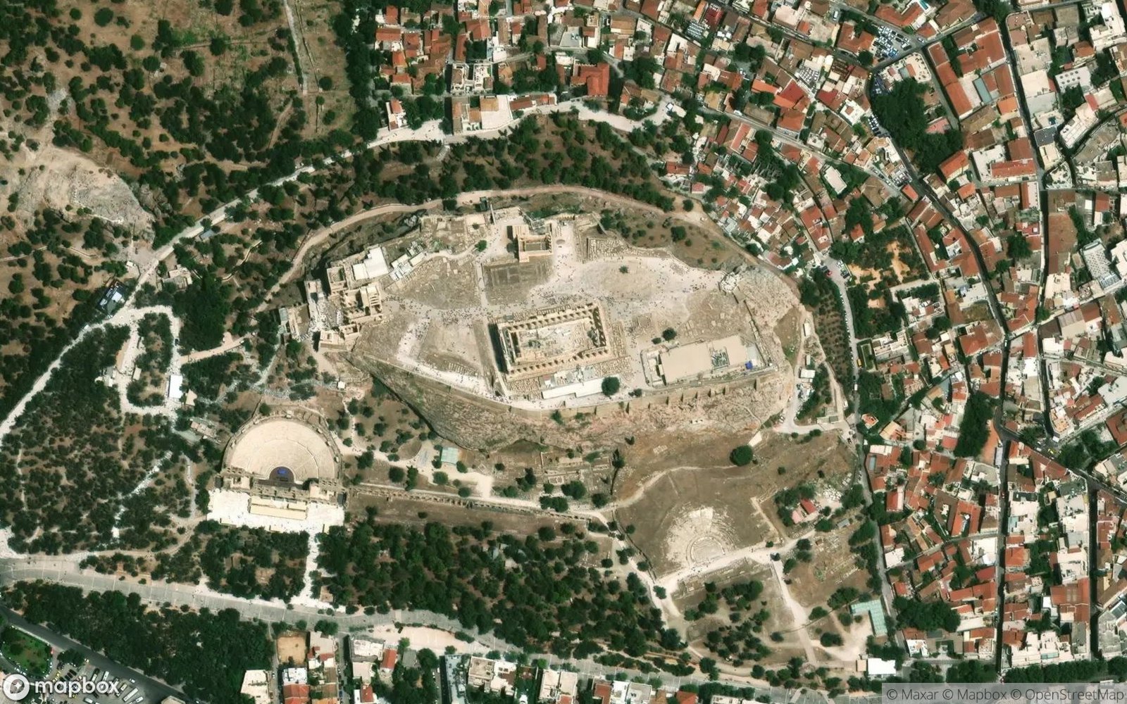
Satellite imagery shows the Acropolis as a stark, white island of history in a sea of dense urban concrete. The Sacred Rock rises abruptly, a natural fortress modified by human genius. The layout of the temples—the Parthenon, the Erechtheion, the Propylaea—follows a deliberate path designed for the Panathenaic procession. The surrounding green slopes of the Agora and Pnyx provide a buffer of nature and history in the heart of Athens.
Walking the sacred way is a pilgrimage to the roots of art and philosophy. It is the wind whipping through the columns, the texture of ancient marble, and the stunning view of the Aegean Sea in the distance. The Acropolis is not just a ruin; it is an ideal, a reminder of the human capacity for reason and beauty that has survived wars, looting, and time itself.