About Bangkok
Bangkok is a sensory explosion, a city where saffron-robed monks walk barefoot past gleaming luxury malls and where the smell of jasmine garlands mingles with street food smoke. Known to locals as Krung Thep, the "City of Angels," it is a chaotic, humidity-soaked metropolis that never sleeps. The Chao Phraya River churns with long-tail boats and rice barges, serving as the city's historic artery, while above, the Skytrain glides through a futuristic skyline of glass and concrete.
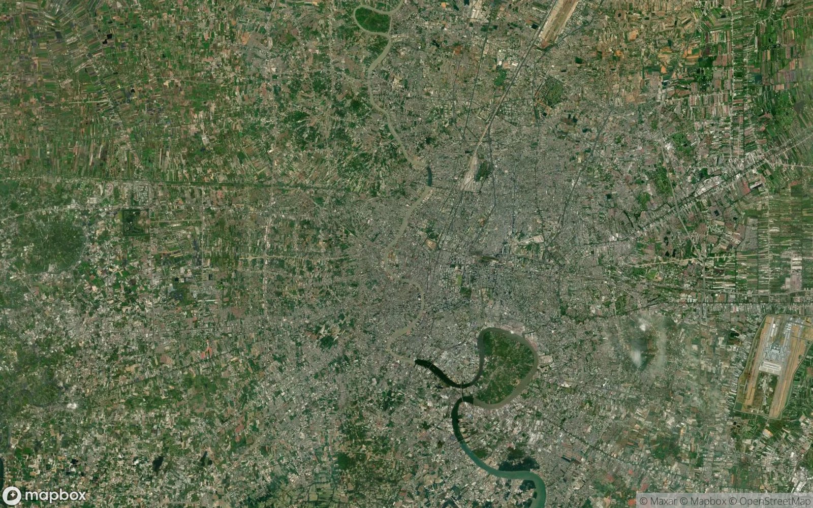
From a satellite perspective, Bangkok appears as a dense, sprawling grey blanket spreading into the lush green of the Thai plains, cut through by the serpentine curves of the river and a network of "klongs" (canals). The city's layout defies logic, a patchwork of old villages and modern high-rises stitched together by traffic-clogged superhighways. Yet, hidden within this density are glittering jewels: the gold-leafed spires of the Grand Palace and the intricate mosaic stupas of Wat Arun, which catch the tropical sun and shine like beacons.
The soul of Bangkok is street-level and edible. It lives in the sizzle of a wok at a roadside stall, the fiery punch of a tom yum soup, and the chaotic energy of Chinatown's neon alleys. It is a city of intense heat and sudden monsoons, of traffic jams and sublime massages, of ancient reverence and modern hedonism. Bangkok demands patience, but rewards it with a vibrant, unpolished, and deeply human beauty that stays with you long after the humidity fades.