💡 Pro Tip: Look for bridges! If you see bridges connecting two sides of a major city over water, it's almost certainly a river, not the ocean. Coastal cities stop abruptly at the water's edge.
1. The Color of Water
Not all water looks the same from space. Color is your first clue.
Coastal cities face water that gets darker blue as it gets deeper further out. You might see white waves or foam near the shore.
Rivers carry sediment, making them look muddy brown or green. They are often uniform in width compared to the vastness of the sea.
2. Port Infrastructure: What kind of boats?
The type of boats and docks visible can tell you if you are looking at a deep-sea port or a river marina.
Look for massive colorful rectangles (containers) stacked in rows and huge gantry cranes. This usually indicates a major coastal hub or very large river access.
"Fishbone" patterns of small white boats. These can be anywhere—lakes, rivers, or coasts—but are often in sheltered bays.
3. Detective Strategy: The Urban Limit
How does the city interact with the water?
-
🌉
The Bridge Test: If the city surrounds the water on both sides and is connected by multiple bridges (like London or Paris), it's an Inland River City.
-
🚢
The Abrupt Stop: If the city grid just ends at a beach or cliff, and there is nothing but blue on the other side, it's a Coastal City (like Miami or Barcelona).
4. River Delta Identification
Deltas create distinctive patterns where rivers meet the sea.
Multiple narrow channels extending into sea like fingers or tree branches. Mississippi River creates classic example. Sediment visible as brownish water plumes.
Triangular shape with braided channels. Nile Delta shows perfect triangle. Green agricultural areas contrast with desert surroundings, fed by sediment-rich water.
5. Coastal Erosion Patterns
Dynamic coastlines show active geological processes.
-
🌊
Cliffed Coasts: Sharp, linear coastlines with white wave breaks at base. Erosion creates capes and bays. Examples: Dover's white cliffs, California's Big Sur.
-
🏖️
Sandy Deposition: Smooth, curved beaches with sandbars visible as light strips offshore. Barrier islands form parallel to mainland. Examples: North Carolina Outer Banks, Netherlands coast.
6. Artificial Coastline Markers
Human engineering creates unnatural but recognizable patterns.
🏗️ Man-made Clues: Land reclamation shows perfect geometric shapes (Dubai's
Palm
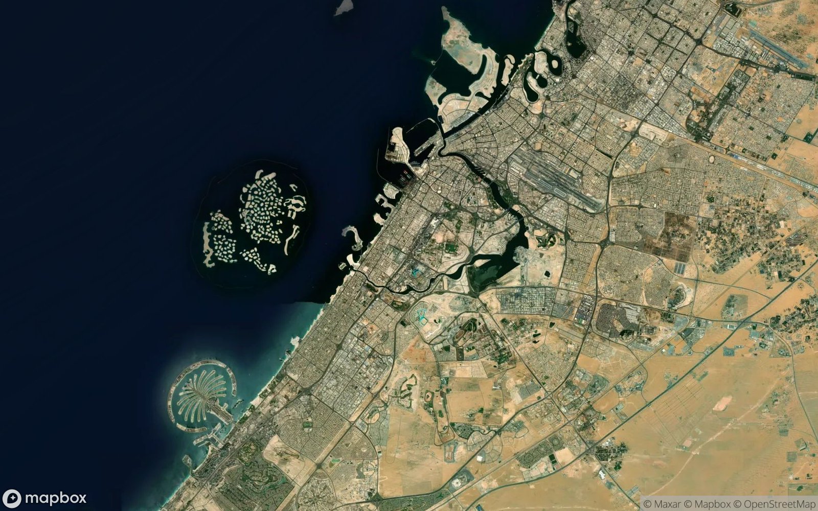 Islands, Singapore's southern expansion). Seawalls create unnaturally straight coastlines. Harbors
display rectangular basins, grid-like docks, and breakwaters (rock barriers protecting ports).
Industrial ports show container terminals as colorful rectangular grids.
Islands, Singapore's southern expansion). Seawalls create unnaturally straight coastlines. Harbors
display rectangular basins, grid-like docks, and breakwaters (rock barriers protecting ports).
Industrial ports show container terminals as colorful rectangular grids.
🗺️ Explore These Locations
Compare coastal and inland cities from satellite view: